Guidance on Lower Gurney Farm
Introduction
The photograph on this page of Guidance on Lower Gurney Farm by Neil Owen as part of the Geograph project.
The Geograph project started in 2005 with the aim of publishing, organising and preserving representative images for every square kilometre of Great Britain, Ireland and the Isle of Man.

There are currently over 7.5m images from over 14,400 individuals and you can help contribute to the project by visiting https://www.geograph.org.uk
Guidance on Lower Gurney Farm
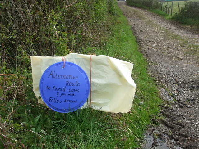
Image: © Neil Owen Taken: 29 Apr 2021
The home-made style of farm signage. The footpath comes up the lane and veers west across the fields beside it and the farm. However, this currently takes walkers into a field with cows and their new-born young - not the most sensible route. Instead, the farm allows users to stay on the lane and go through the farm buildings instead. As it happened, a young farmer was there at the gate, beckoning the safer use of the lane.
Images are licensed for reuse under creativecommons.org/licenses/by-sa/2.0
Image Location
Latitude
51.31953
Longitude
-2.624159