Old Boundary Marker on Whitchurch Lane, Bristol
Introduction
The photograph on this page of Old Boundary Marker on Whitchurch Lane, Bristol by J Dowding as part of the Geograph project.
The Geograph project started in 2005 with the aim of publishing, organising and preserving representative images for every square kilometre of Great Britain, Ireland and the Isle of Man.

There are currently over 7.5m images from over 14,400 individuals and you can help contribute to the project by visiting https://www.geograph.org.uk
Old Boundary Marker on Whitchurch Lane, Bristol
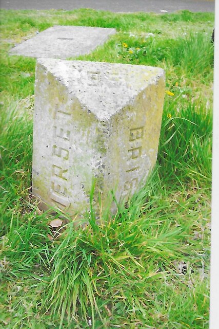
Image: © J Dowding Taken: 27 Apr 2021
County Boundary Marker on the southeast side of the junction of Whitchurch Lane and Half Acre Lane. On the former boundary of Whitchurch parish, Somerset and the City of Bristol where the county boundary was moved in 1951. Now entirely inside the city boundary. Inscribed SOMERSET on the left face, BRISTOL on the right face and 1951 on the bevelled top face. Milestone Society National ID: SO_BRIS18cb
Images are licensed for reuse under creativecommons.org/licenses/by-sa/2.0
Image Location
Latitude
51.406494
Longitude
-2.568554