St. Pauls Church, Stafford
Introduction
The photograph on this page of St. Pauls Church, Stafford by Brian Deegan as part of the Geograph project.
The Geograph project started in 2005 with the aim of publishing, organising and preserving representative images for every square kilometre of Great Britain, Ireland and the Isle of Man.

There are currently over 7.5m images from over 14,400 individuals and you can help contribute to the project by visiting https://www.geograph.org.uk
St. Pauls Church, Stafford
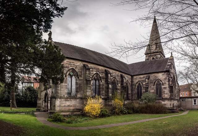
Image: © Brian Deegan Taken: 10 Apr 2021
Built in 1844, the spire being added in 1887. Listed Grade II. Is also a Trig intersected station TP14750 - Stafford St Pauls Church Spire http://trigpointing.uk/trig/14750
Images are licensed for reuse under creativecommons.org/licenses/by-sa/2.0
Image Location
Latitude
52.801986
Longitude
-2.109274