The Bogs
Introduction
The photograph on this page of The Bogs by Stephen McKay as part of the Geograph project.
The Geograph project started in 2005 with the aim of publishing, organising and preserving representative images for every square kilometre of Great Britain, Ireland and the Isle of Man.

There are currently over 7.5m images from over 14,400 individuals and you can help contribute to the project by visiting https://www.geograph.org.uk
The Bogs
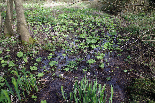
Image: © Stephen McKay Taken: 31 Mar 2021
The Bogs is a 0.49 hectare of wetland fed by springs immediately to the north of North Kilworth Millennium Green. The area was once used for gravel extraction and, from 1890, as the village rubbish dump. It has now been cleaned up and is home to a variety of plant species including butterbur, which can be seen flowering in this springtime view. After flowering, butterbur (petasites hybridus), also known as wild rhubarb, grows very large leaves, up to 1m in diameter, which used to be used to preserve butter.
Images are licensed for reuse under creativecommons.org/licenses/by-sa/2.0
Image Location
Latitude
52.44454
Longitude
-1.092346