Old benchmark on jamb of building at Hall Bank
Introduction
The photograph on this page of Old benchmark on jamb of building at Hall Bank by Roger Templeman as part of the Geograph project.
The Geograph project started in 2005 with the aim of publishing, organising and preserving representative images for every square kilometre of Great Britain, Ireland and the Isle of Man.

There are currently over 7.5m images from over 14,400 individuals and you can help contribute to the project by visiting https://www.geograph.org.uk
Old benchmark on jamb of building at Hall Bank
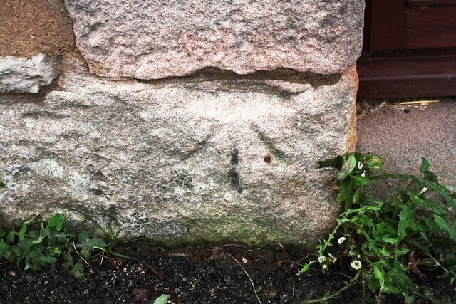
Image: © Roger Templeman Taken: 19 Feb 2020
Ordnance Survey cut mark benchmark described on the Bench Mark Database at www.bench-marks.org.uk/bm67410. The mark was cut in 1855 as part of the Penrith to Workington survey line and levelled at 535.415 feet above Liverpool Datum. The surveyor's description was ' Mark on jamb of door of Mr. Redley's barn, at East end of Stainton Village'. The doorway is now a window.
Images are licensed for reuse under creativecommons.org/licenses/by-sa/2.0
Image Location
Latitude
54.647454
Longitude
-2.796349