Clare houses [58]
Introduction
The photograph on this page of Clare houses [58] by Michael Dibb as part of the Geograph project.
The Geograph project started in 2005 with the aim of publishing, organising and preserving representative images for every square kilometre of Great Britain, Ireland and the Isle of Man.

There are currently over 7.5m images from over 14,400 individuals and you can help contribute to the project by visiting https://www.geograph.org.uk
Clare houses [58]
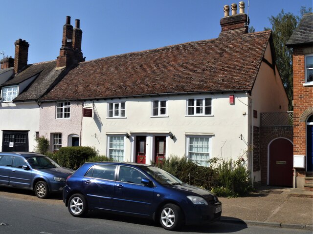
Image: © Michael Dibb Taken: 14 Sep 2020
Numbers 24 to 26 Nethergate Street are a range of 17th century (or possibly earlier) timber framed and plastered cottages, refronted in the 19th century and now faced in roughcast. Numbers 25 and 26 have been combined into one property which offers bed and breakfast accommodation. Listed, grade II, with details at: https://historicengland.org.uk/listing/the-list/list-entry/1180612 The market town of Clare is Suffolk’s smallest town. It lies on the north bank of the River Stour some 12 miles south of Bury St Edmunds and some 7 miles west of Sudbury. Remains of every period since the Palaeolithic have been found in the area. There is a Norman castle, a 13th century Augustinian Priory and a fine, medieval ‘wool’ church as well as many listed buildings, some of which date to the 16th century or earlier.
Images are licensed for reuse under creativecommons.org/licenses/by-sa/2.0
Image Location


Leaflet Map data © OpenStreetMap
Latitude
52.076639
Longitude
0.579514