Bank Bottom Mill, Marsden
Introduction
The photograph on this page of Bank Bottom Mill, Marsden by Chris Allen as part of the Geograph project.
The Geograph project started in 2005 with the aim of publishing, organising and preserving representative images for every square kilometre of Great Britain, Ireland and the Isle of Man.

There are currently over 7.5m images from over 14,400 individuals and you can help contribute to the project by visiting https://www.geograph.org.uk
Bank Bottom Mill, Marsden
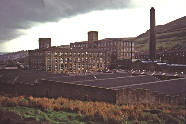
Image: © Chris Allen Taken: 10 May 1992
According to Alexander Kapp - Viewed from Mount Road. It was built in 1801, and eventually replaced Top Bank Mill, which was demolished in 1891. It closed down in 2003. This incorporates both north light roof sheds and multistorey blocks in keeping with an integrated woollen mill. The original slide was both very dark and showed fungal hyphae in the sky. I have done my best to address both these issues on the scanned image.
Images are licensed for reuse under creativecommons.org/licenses/by-sa/2.0
Image Location
Latitude
53.596452
Longitude
-1.92925