Clink Road Junction and Signal Box, 1984
Introduction
The photograph on this page of Clink Road Junction and Signal Box, 1984 by Nigel Thompson as part of the Geograph project.
The Geograph project started in 2005 with the aim of publishing, organising and preserving representative images for every square kilometre of Great Britain, Ireland and the Isle of Man.

There are currently over 7.5m images from over 14,400 individuals and you can help contribute to the project by visiting https://www.geograph.org.uk
Clink Road Junction and Signal Box, 1984
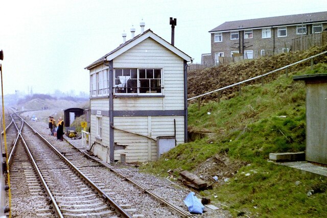
Image: © Nigel Thompson Taken: 15 Mar 1984
Taken from a train crossing over to take the line to Frome, diverging right. The 'box is long since gone as the junction is controlled remotely, but the sloping path and handrail on the right can still be seen. Interestingly, the 114½ milepost seen outside the 'box is not measured by the direct route from London, but the original route via Swindon and Melksham. The actual mileage from London via the later, more direct route via Newbury, is about 15 miles shorter.
Images are licensed for reuse under creativecommons.org/licenses/by-sa/2.0
Image Location
Latitude
51.236481
Longitude
-2.294303