Old Boundary Marker in Hockley Woods
Introduction
The photograph on this page of Old Boundary Marker in Hockley Woods by L Chinea as part of the Geograph project.
The Geograph project started in 2005 with the aim of publishing, organising and preserving representative images for every square kilometre of Great Britain, Ireland and the Isle of Man.

There are currently over 7.5m images from over 14,400 individuals and you can help contribute to the project by visiting https://www.geograph.org.uk
Old Boundary Marker in Hockley Woods
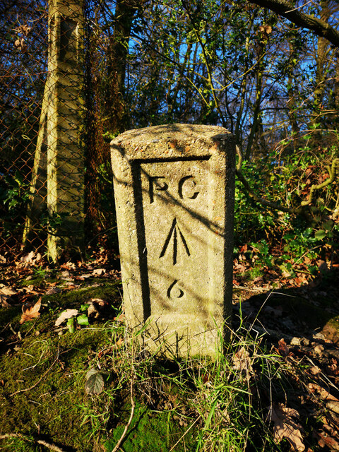
Image: © L Chinea Taken: Unknown
Prison Commission Boundary Marker by a fence post at a change in direction on the southern boundary of the former HM Prison Bullwood Hall in Hockley Woods. Rayleigh parish. Inscribed P C / ↑ / 6. Dated to the early 1960’s because the Prison Commission became part of the Home Office in 1963 and Bullwood Hall was built as a female borstal in the 1960's. Milestone Society National ID: EX_PCBULL06em
Images are licensed for reuse under creativecommons.org/licenses/by-sa/2.0
Image Location
Latitude
51.591881
Longitude
0.63669