Muswell Hill : Tetherdown Primary School
Introduction
The photograph on this page of Muswell Hill : Tetherdown Primary School by Jim Osley as part of the Geograph project.
The Geograph project started in 2005 with the aim of publishing, organising and preserving representative images for every square kilometre of Great Britain, Ireland and the Isle of Man.

There are currently over 7.5m images from over 14,400 individuals and you can help contribute to the project by visiting https://www.geograph.org.uk
Muswell Hill : Tetherdown Primary School
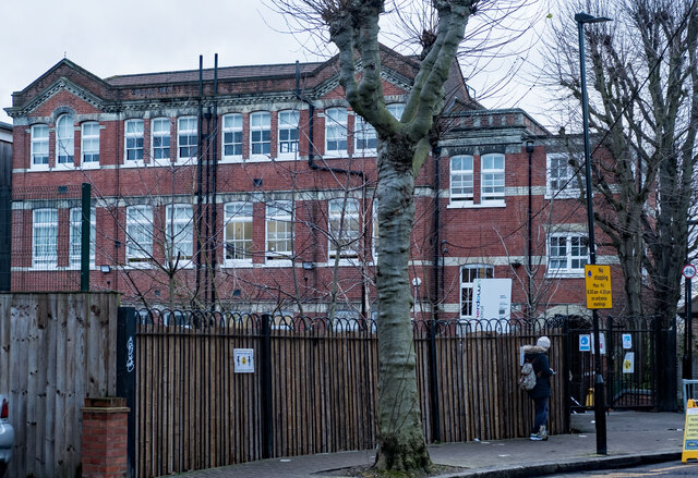
Image: © Jim Osley Taken: 12 Jan 2021
The image shows the older building of the Tetherdown Primary School site. It dates from 1910 and was built for the Tollington School for Girls to a design by Alfred Conder.
Images are licensed for reuse under creativecommons.org/licenses/by-sa/2.0
Image Location
Latitude
51.587814
Longitude
-0.151906