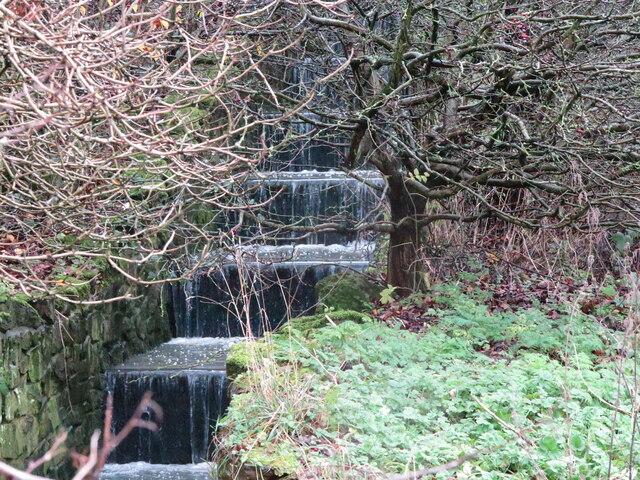
Surface Water Inlet (Cascade), Marden Quarry Park, Whitley Bay
Introduction
The photograph on this page of Surface Water Inlet (Cascade), Marden Quarry Park, Whitley Bay by Geoff Holland as part of the Geograph project.
The Geograph project started in 2005 with the aim of publishing, organising and preserving representative images for every square kilometre of Great Britain, Ireland and the Isle of Man.
There are currently over 7.5m images from over 14,400 individuals and you can help contribute to the project by visiting https://www.geograph.org.uk

Image: © Geoff Holland Taken: 8 Dec 2020
This surface water inlet was in full flow after heavy overnight rain. The surface water which flows into the park's lake eventually discharges into the North Sea just north of Cliff House, Cullercoats. The history of Marden Quarry dates back to 1684 when the land was leased for quarrying purposes. During its working life the quarry contained large lime kilns, a brickworks, a tower, which served as offices and an explosives store, and a number of cottages for quarry workers. When quarrying finally ended in 1880 at which time the site stretched from Hillheads Road to the north and covered both the rugby and cricket grounds to the west. Eventually, after lying unused for many years, the land was passed to the former Whitley Bay Borough Council and Marden Quarry Park, as we know it today, was subsequently created. The park was officially opened by Princess Margaret on November 22, 1977. Designated as a Local Nature Reserve, the park is home to a variety of breeding wildfowl including Mute Swans, Mallards, Moorhens, Coots and Tufted Ducks. For a selection of detailed free to download walking routes in the area visit www.northtynesidewalks.co.uk

