Bury St Edmunds buildings [205]
Introduction
The photograph on this page of Bury St Edmunds buildings [205] by Michael Dibb as part of the Geograph project.
The Geograph project started in 2005 with the aim of publishing, organising and preserving representative images for every square kilometre of Great Britain, Ireland and the Isle of Man.

There are currently over 7.5m images from over 14,400 individuals and you can help contribute to the project by visiting https://www.geograph.org.uk
Bury St Edmunds buildings [205]
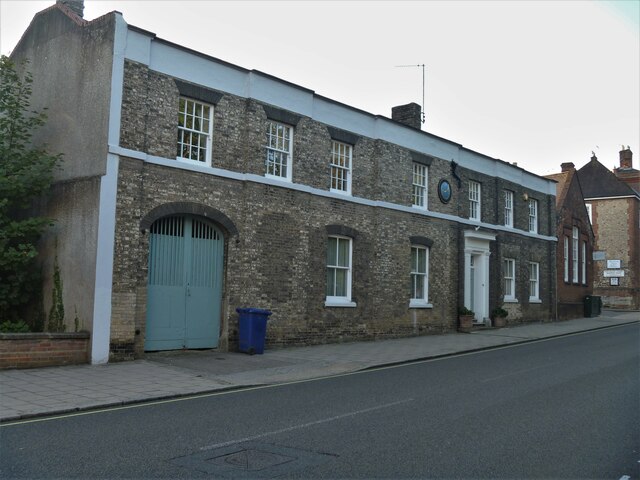
Image: © Michael Dibb Taken: 10 Sep 2020
This rather unusual building at 109 Northgate Street is known as The Clock House and appears to be as much commercial as residential. North of the town centre Northgate Street and St John’s Street run towards the site of Northgate and the railway station and both streets have many older buildings. In between these two streets is a number of streets irregularly laid out (compared to the medieval grid of the town centre) containing mostly houses and buildings from the 19th century. Bury St Edmunds is a market town which is the cultural and retail centre for West Suffolk and is known for brewing (Greene King) and sugar (British Sugar). There is scattered evidence of earlier activity but essentially Bury St Edmunds began as one of the royal boroughs of the Saxons and a monastery was founded which became the burial place of King Edmund. A new Benedictine abbey was built in 1020 which became rich and powerful and the town was laid out on a grid pattern by Abbot Baldwin. After the dissolution the abbey became ruinous. A new church, later the cathedral, was begun in the early 16th century.
Images are licensed for reuse under creativecommons.org/licenses/by-sa/2.0
Image Location
Latitude
52.248745
Longitude
0.71637