Bury St Edmunds, Eastgate sign
Introduction
The photograph on this page of Bury St Edmunds, Eastgate sign by Adrian S Pye as part of the Geograph project.
The Geograph project started in 2005 with the aim of publishing, organising and preserving representative images for every square kilometre of Great Britain, Ireland and the Isle of Man.

There are currently over 7.5m images from over 14,400 individuals and you can help contribute to the project by visiting https://www.geograph.org.uk
Bury St Edmunds, Eastgate sign
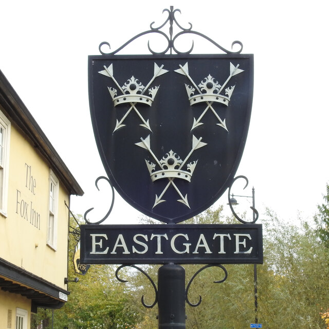
Image: © Adrian S Pye Taken: 26 Oct 2020
The sign shows three crowns, each pierced by two arrows saltire, the crest of the great abbey which grew up around Saint Edmund’s shrine. King Edmund of East Anglia, otherwise known as Edmund the Martyr was King from 855 until he was killed at an unidentified place known as Haegelisdun, after he refused the Danes' demand that he renounce Christ: the Danes beat him, shot him with arrows and then beheaded him just to be on the safe side. His body was taken to what is now Bury St Edmunds and a shrine was created. I don’t think anyone knows what Bury St Edmunds was called before it was re-named Bury St. Edmunds; Haegelisdun perhaps. https://www.geograph.org.uk/photo/6655804
Images are licensed for reuse under creativecommons.org/licenses/by-sa/2.0
Image Location
Latitude
52.246243
Longitude
0.719968