Watford: A41 North Western Avenue
Introduction
The photograph on this page of Watford: A41 North Western Avenue by Nigel Cox as part of the Geograph project.
The Geograph project started in 2005 with the aim of publishing, organising and preserving representative images for every square kilometre of Great Britain, Ireland and the Isle of Man.

There are currently over 7.5m images from over 14,400 individuals and you can help contribute to the project by visiting https://www.geograph.org.uk
Watford: A41 North Western Avenue
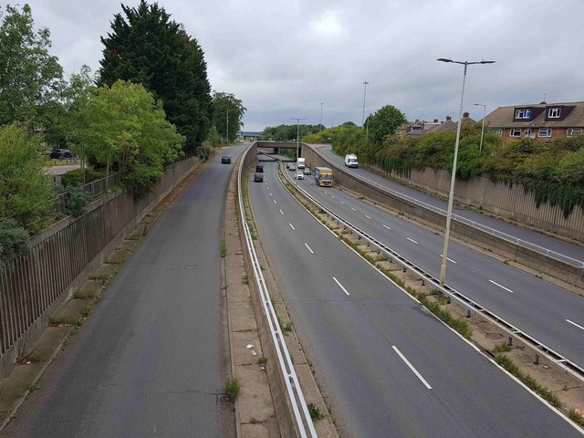
Image: © Nigel Cox Taken: 3 Sep 2020
This is the view looking west from the footbridge that connects Leggatts Way and the present-day Leggatts Rise. When it was first built this section of the current A41 was the A500, and was also known then as Leggatts Rise. The slip road on the left leads up to the elevated roundabout junction with the A405 North Orbital Road. The 1939 large scale OS map shows that when these two roads were first built, the A405 Kingsway North Orbital Road, as it then was, formed a T-junction with the A500.
Images are licensed for reuse under creativecommons.org/licenses/by-sa/2.0
Image Location
Latitude
51.684702
Longitude
-0.412984