The Manor House and Cad Beeston
Introduction
The photograph on this page of The Manor House and Cad Beeston by Stephen Craven as part of the Geograph project.
The Geograph project started in 2005 with the aim of publishing, organising and preserving representative images for every square kilometre of Great Britain, Ireland and the Isle of Man.

There are currently over 7.5m images from over 14,400 individuals and you can help contribute to the project by visiting https://www.geograph.org.uk
The Manor House and Cad Beeston
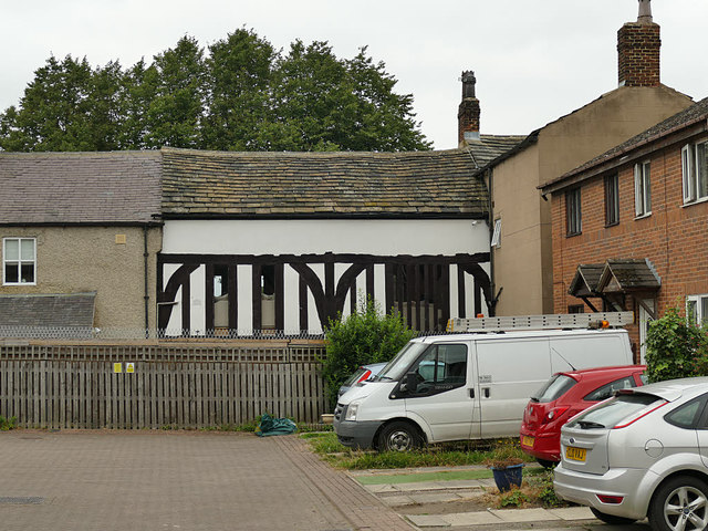
Image: © Stephen Craven Taken: 15 Aug 2020
Tucked away round the back of some modern housing, it seems other contributors have missed this gem, and I was only alerted to it by an information board in the nearby cemetery. The timber-framed section is what remains of the old medieval Manor House of Beeston, dating from c.1421, restored 1985 and grade II* listed (entry 1255940); the section to the right is a 19th century house known as Cad Beeston, grade II listed (entry 1255939) and the section to the left is a 19th century extension.
Images are licensed for reuse under creativecommons.org/licenses/by-sa/2.0
Image Location
Latitude
53.778297
Longitude
-1.557924