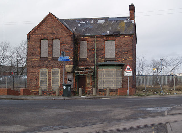
Derelict building near Whitehouse Crossing
Introduction
The photograph on this page of Derelict building near Whitehouse Crossing by Stephen McCulloch as part of the Geograph project.
The Geograph project started in 2005 with the aim of publishing, organising and preserving representative images for every square kilometre of Great Britain, Ireland and the Isle of Man.
There are currently over 7.5m images from over 14,400 individuals and you can help contribute to the project by visiting https://www.geograph.org.uk

Image: © Stephen McCulloch Taken: 14 Jan 2008
On the corner of Marsh Road and Cargo Fleet Road (to the left). Whitehouse level crossing is just off-picture to the right. Taken from outside of The Navigation public house. I do not know what this building was used for nor why it should have escaped when the surrounding factories were demolished in the 80s. Anybody else know?

