Rothes
Introduction
The photograph on this page of Rothes by Anne Burgess as part of the Geograph project.
The Geograph project started in 2005 with the aim of publishing, organising and preserving representative images for every square kilometre of Great Britain, Ireland and the Isle of Man.

There are currently over 7.5m images from over 14,400 individuals and you can help contribute to the project by visiting https://www.geograph.org.uk
Rothes
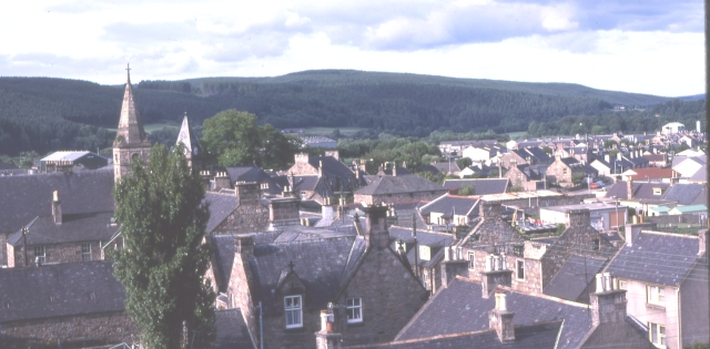
Image: © Anne Burgess Taken: 16 Jul 1983
Rothes was founded in 1776. Although this view from the castle ruins shows it as a huddle of roofs, it is in fact a planned town with a rectangular street plan. Its economy depends on whisky distilling.
Images are licensed for reuse under creativecommons.org/licenses/by-sa/2.0
Image Location


Leaflet Map data © OpenStreetMap
Latitude
57.529817
Longitude
-3.212372