Farm track and bridleway near Car Colston
Introduction
The photograph on this page of Farm track and bridleway near Car Colston by Alan Murray-Rust as part of the Geograph project.
The Geograph project started in 2005 with the aim of publishing, organising and preserving representative images for every square kilometre of Great Britain, Ireland and the Isle of Man.

There are currently over 7.5m images from over 14,400 individuals and you can help contribute to the project by visiting https://www.geograph.org.uk
Farm track and bridleway near Car Colston
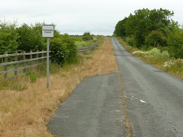
Image: © Alan Murray-Rust Taken: 7 Jun 2020
This is the former A46 roadway – Fosse Way. The tarmacked section is the southbound lane of the old roadway, the northbound lane being covered with soil to make it more suitable for horses, with a few sections left bare as passing places. Just visible are the remains of a white arrow from the old road surface. The new A46 is to the left of the fence. The parched nature of the bridleway side is the result of two months with very little rain where the old tarmac is only thinly covered.
Images are licensed for reuse under creativecommons.org/licenses/by-sa/2.0
Image Location


Leaflet Map data © OpenStreetMap
Latitude
52.992198
Longitude
-0.929393