Tilford House Farmhouse
Introduction
The photograph on this page of Tilford House Farmhouse by Derek Harper as part of the Geograph project.
The Geograph project started in 2005 with the aim of publishing, organising and preserving representative images for every square kilometre of Great Britain, Ireland and the Isle of Man.

There are currently over 7.5m images from over 14,400 individuals and you can help contribute to the project by visiting https://www.geograph.org.uk
Tilford House Farmhouse
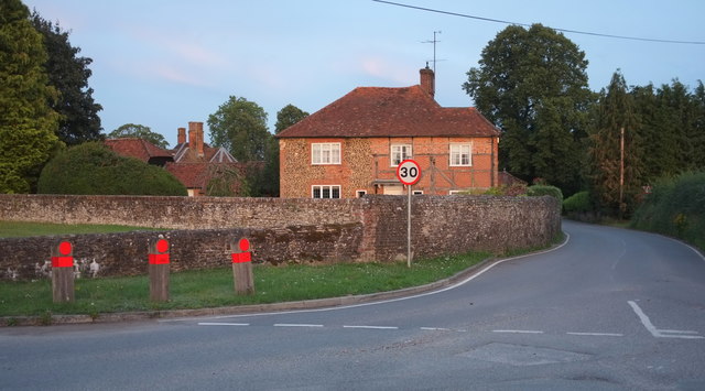
Image: © Derek Harper Taken: 17 Aug 2019
Listed and described at https://historicengland.org.uk/listing/the-list/list-entry/1352765 :"Timber framed to right with brick infill, once colourwashed and now worn away, some in diagonal pattern, Bargate stone rubble with brick dressings to left". In the foreground is the junction shown in Image As with Image], part of the roof of the grade II* listed Tilford House https://historicengland.org.uk/listing/the-list/list-entry/1352763 can be seen on the left.
Images are licensed for reuse under creativecommons.org/licenses/by-sa/2.0
Image Location
Latitude
51.185209
Longitude
-0.757582