Old Forge (Smithy), Brookland Terrace, New York
Introduction
The photograph on this page of Old Forge (Smithy), Brookland Terrace, New York by Geoff Holland as part of the Geograph project.
The Geograph project started in 2005 with the aim of publishing, organising and preserving representative images for every square kilometre of Great Britain, Ireland and the Isle of Man.

There are currently over 7.5m images from over 14,400 individuals and you can help contribute to the project by visiting https://www.geograph.org.uk
Old Forge (Smithy), Brookland Terrace, New York
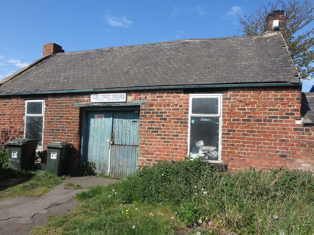
Image: © Geoff Holland Taken: 1 May 2020
It is thought that a forge has stood on this site since the mid-18th century. However, as this point was once an important medieval crossroads linking the monasteries of Lindisfarne and Jarrow, it is conceivable that a forge stood here long before the mid-18th century. When the first Ordnance Survey Six-Inch map of the area was published in 1865, the forge was not named on the map although the adjacent building was referred to as the 'Traveller's Rest (P.H.)'. When the 1898 Ordnance Survey map was published, the public house no longer existed and the only property shown and named on the map at this point was a 'Smithy'. This gives weight to the belief that the current brick building was built at some time between the publication of the two maps. For a selection of detailed free to download walking routes in the area visit www.northtynesidewalks.co.uk
Images are licensed for reuse under creativecommons.org/licenses/by-sa/2.0
Image Location
Latitude
55.02498
Longitude
-1.48613