Northbourne: Ashridge Avenue
Introduction
The photograph on this page of Northbourne: Ashridge Avenue by Chris Downer as part of the Geograph project.
The Geograph project started in 2005 with the aim of publishing, organising and preserving representative images for every square kilometre of Great Britain, Ireland and the Isle of Man.

There are currently over 7.5m images from over 14,400 individuals and you can help contribute to the project by visiting https://www.geograph.org.uk
Northbourne: Ashridge Avenue
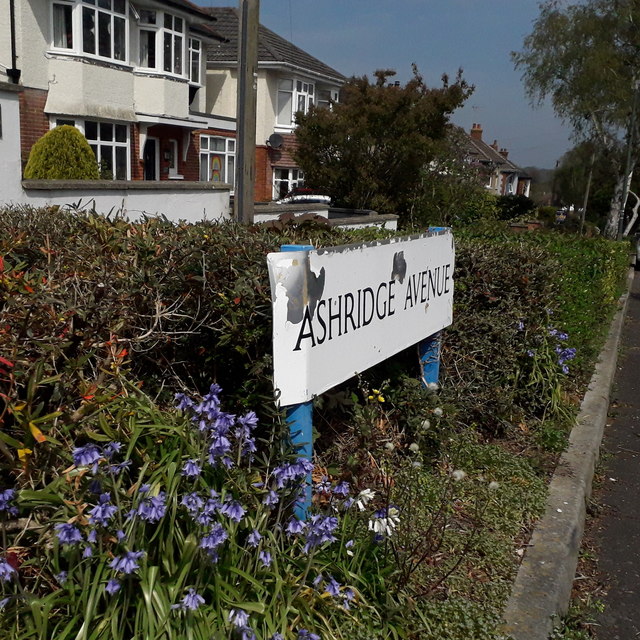
Image: © Chris Downer Taken: 12 Apr 2020
Looking down this row of detached houses from the top end of Ashridge Avenue, the pavement separated from the road by a hedge, interrupted at each driveway. The sign is of a design that became prevalent in Bournemouth around 1990 and was in use for most of that decade. Many are starting to look a bit shabby now, such as this one with peeling white section, while the original blue border has completely gone (see Image for a better example – also, the name might look better more broadly spaces on two lines like at Aberdare Road, or on the narrower version of the same sign such as at Image]). This is photo no.18 of a series of 451 in my coronavirus lockdown walking project: See https://www.geograph.org.uk/article/My-2020-Coronavirus-Lockdown-walking-project for the complete set of photos.
Images are licensed for reuse under creativecommons.org/licenses/by-sa/2.0
Image Location
Latitude
50.765968
Longitude
-1.890907