Old Turnpike Stone at Latchbrook, west of Saltash
Introduction
The photograph on this page of Old Turnpike Stone at Latchbrook, west of Saltash by Rosy Hanns as part of the Geograph project.
The Geograph project started in 2005 with the aim of publishing, organising and preserving representative images for every square kilometre of Great Britain, Ireland and the Isle of Man.

There are currently over 7.5m images from over 14,400 individuals and you can help contribute to the project by visiting https://www.geograph.org.uk
Old Turnpike Stone at Latchbrook, west of Saltash
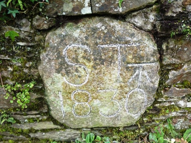
Image: © Rosy Hanns Taken: 20 Mar 2019
Turnpike stone set in roadside wall, South side of road, Latchbrook Farm. Presumably set up by the Saltash Turnpike Trust in the 19th century. Inscription reads:- ST 1830 Carved benchmark on right hand side. Cornwall & Scilly HER. HER Number: MCO57964 https://www.heritagegateway.org.uk/Gateway/Results_Single.aspx?uid=MCO57964&resourceID=1020 Milestone Society National ID: CW_SHLK01cm
Images are licensed for reuse under creativecommons.org/licenses/by-sa/2.0
Image Location
Latitude
50.413112
Longitude
-4.246175