Old Boundary Marker
Introduction
The photograph on this page of Old Boundary Marker by Mr Red as part of the Geograph project.
The Geograph project started in 2005 with the aim of publishing, organising and preserving representative images for every square kilometre of Great Britain, Ireland and the Isle of Man.

There are currently over 7.5m images from over 14,400 individuals and you can help contribute to the project by visiting https://www.geograph.org.uk
Old Boundary Marker
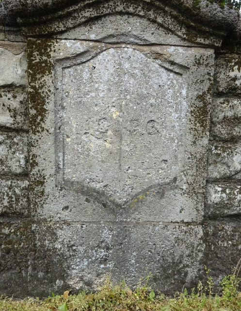
Image: © Mr Red Taken: 3 Apr 2019
Municipal Boundary Marker on the northeast bridge pilaster of Branwood Bridge, Wotton Brook on the A38 Barnwood Road, Gloucester. Marks the Gloucester City boundary. Milestone Society National ID: GL_GLOU03pb
Images are licensed for reuse under creativecommons.org/licenses/by-sa/2.0
Image Location
Latitude
51.867536
Longitude
-2.224018