Former slaughterhouse, Totnes
Introduction
The photograph on this page of Former slaughterhouse, Totnes by Derek Harper as part of the Geograph project.
The Geograph project started in 2005 with the aim of publishing, organising and preserving representative images for every square kilometre of Great Britain, Ireland and the Isle of Man.

There are currently over 7.5m images from over 14,400 individuals and you can help contribute to the project by visiting https://www.geograph.org.uk
Former slaughterhouse, Totnes
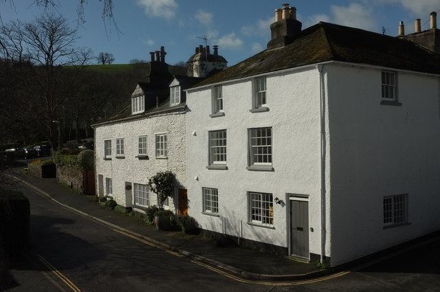
Image: © Derek Harper Taken: 25 Feb 2020
This row on Leechwell Lane is listed https://historicengland.org.uk/listing/the-list/list-entry/1236466 and https://historicengland.org.uk/listing/the-list/list-entry/1264569 . "Mentioned in 1750 deed as "Dwellinghouse, slaughterhouse, linhay, stables and outhouses". The linhay (combined cattle shelter with haystore over) and outbuildings were converted into cottages circa 1880 (... Nos 3-5 Leechwell Lane).
Images are licensed for reuse under creativecommons.org/licenses/by-sa/2.0
Image Location
Latitude
50.430549
Longitude
-3.689207