Stobbs Cross Lane entering West Cornforth
Introduction
The photograph on this page of Stobbs Cross Lane entering West Cornforth by Trevor Littlewood as part of the Geograph project.
The Geograph project started in 2005 with the aim of publishing, organising and preserving representative images for every square kilometre of Great Britain, Ireland and the Isle of Man.

There are currently over 7.5m images from over 14,400 individuals and you can help contribute to the project by visiting https://www.geograph.org.uk
Stobbs Cross Lane entering West Cornforth
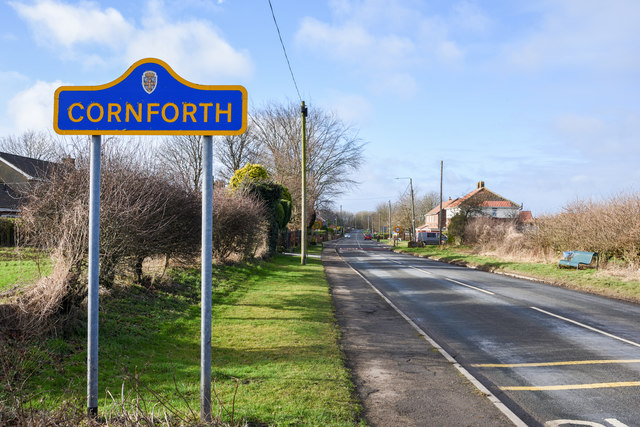
Image: © Trevor Littlewood Taken: 1 Feb 2020
Stobbs Cross Lane heading west into the village passing a typical County Durham road sign in blue and yellow, naming it. Note: The settlement at 'Cornforth' is in two contiguous parts... Cornforth and West Cornforth; they're named so on OS maps. The buildings ahead in the image are in West Cornforth yet the road sign names Cornforth! It might have been that the sign was planned to serve for both parts of the settlement but there's a similar reversal of sign and entry at NZ 3051 3445, where it's clearly Cornforth that is being entered, but the road sign reads West Cornforth. Have the signs have been erected in the wrong places? On the other hand, West Cornforth as named on OS maps is, if anything, more to the east of Cornforth! It could be that the OS has the names printed in misleading places.
Images are licensed for reuse under creativecommons.org/licenses/by-sa/2.0
Image Location
Latitude
54.697411
Longitude
-1.504861