Fruitlands Estate
Introduction
The photograph on this page of Fruitlands Estate by Philip Halling as part of the Geograph project.
The Geograph project started in 2005 with the aim of publishing, organising and preserving representative images for every square kilometre of Great Britain, Ireland and the Isle of Man.

There are currently over 7.5m images from over 14,400 individuals and you can help contribute to the project by visiting https://www.geograph.org.uk
Fruitlands Estate
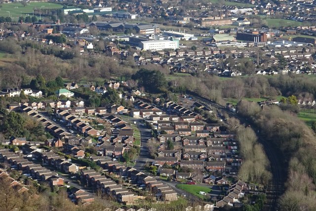
Image: © Philip Halling Taken: 29 Jan 2020
Fruitlands Estate viewed from Perseverance Hill in the Malvern Hills. The larger commercial buildings in the background are part of the former Qiniteq site and are soon to be demolished for redevelopment.
Images are licensed for reuse under creativecommons.org/licenses/by-sa/2.0
Image Location
Latitude
52.094342
Longitude
-2.325609