2007 : The Warminster Road, Beckington
Introduction
The photograph on this page of 2007 : The Warminster Road, Beckington by Maurice Pullin as part of the Geograph project.
The Geograph project started in 2005 with the aim of publishing, organising and preserving representative images for every square kilometre of Great Britain, Ireland and the Isle of Man.

There are currently over 7.5m images from over 14,400 individuals and you can help contribute to the project by visiting https://www.geograph.org.uk
2007 : The Warminster Road, Beckington
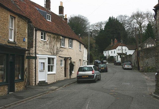
Image: © Maurice Pullin Taken: 17 Dec 2007
A few years ago this quiet, idyllic village scene was the A36 trunk road between Bath and Warminster. Imagine this view with a host of huge lorries pushing through in both directions then moan as much as you like about bypasses if you have a mind to. The Woolpack Inn is to the right of the camera.
Images are licensed for reuse under creativecommons.org/licenses/by-sa/2.0
Image Location


Leaflet Map data © OpenStreetMap
Latitude
51.264827
Longitude
-2.285598