The flooded River Medway at Teston Bridge
Introduction
The photograph on this page of The flooded River Medway at Teston Bridge by Marathon as part of the Geograph project.
The Geograph project started in 2005 with the aim of publishing, organising and preserving representative images for every square kilometre of Great Britain, Ireland and the Isle of Man.

There are currently over 7.5m images from over 14,400 individuals and you can help contribute to the project by visiting https://www.geograph.org.uk
The flooded River Medway at Teston Bridge
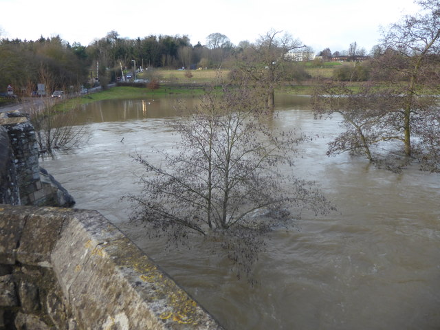
Image: © Marathon Taken: 22 Dec 2019
There was a great deal of rain in the second half of December 2019 and photographs of the medieval Teston Bridge featured in several national newspapers. This is what is it is normally like as in this photograph taken in August 2019 https://www.geograph.org.uk/photo/6236117 and the river is followed by the Medway Valley Walk as here https://www.geograph.org.uk/photo/3063253 By 22nd December the water was up to the underneath of the arches and the nearby Teston Bridge Country Park was completely flooded. However, the bridge could still be reached and crossed whereas on Christmas Day 2013 the bridge was completely inaccessible as the road to it was flooded and a car could be seen submerged in the water - see https://www.geograph.org.uk/photo/3789774 and https://www.geograph.org.uk/photo/3789790 This is looking along the downriver side of the bridge towards the level crossing on the Medway Valley Line with the A26 (Tonbridge Road) beyond.
Images are licensed for reuse under creativecommons.org/licenses/by-sa/2.0
Image Location
Latitude
51.253749
Longitude
0.445609