Pontop Cottage, Dipton
Introduction
The photograph on this page of Pontop Cottage, Dipton by Robert Graham as part of the Geograph project.
The Geograph project started in 2005 with the aim of publishing, organising and preserving representative images for every square kilometre of Great Britain, Ireland and the Isle of Man.

There are currently over 7.5m images from over 14,400 individuals and you can help contribute to the project by visiting https://www.geograph.org.uk
Pontop Cottage, Dipton
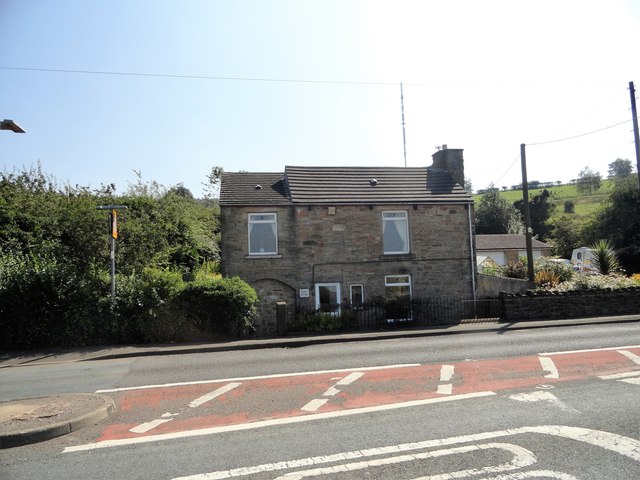
Image: © Robert Graham Taken: 26 Aug 2019
This old cottage stands beside the A692 on the west side of the village. It dates from when the road was established in the late 18th century after the Lanchester Commons Enclosure Act of 1781. It has obviously been much modified over the years.
Images are licensed for reuse under creativecommons.org/licenses/by-sa/2.0
Image Location
Latitude
54.872728
Longitude
-1.773549