The Thatched Tavern, Honeybourne
Introduction
The photograph on this page of The Thatched Tavern, Honeybourne by Eirian Evans as part of the Geograph project.
The Geograph project started in 2005 with the aim of publishing, organising and preserving representative images for every square kilometre of Great Britain, Ireland and the Isle of Man.

There are currently over 7.5m images from over 14,400 individuals and you can help contribute to the project by visiting https://www.geograph.org.uk
The Thatched Tavern, Honeybourne
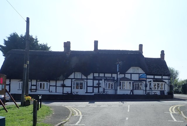
Image: © Eirian Evans Taken: 26 Aug 2019
On the High Street at the southern end of the village. Formerly a house, now a public house. Probably C16, extended C17, with some C18 and mid-C20 alterations. Timber-frame with rendered infill and thatched roof. It is Grade II listed.
Images are licensed for reuse under creativecommons.org/licenses/by-sa/2.0
Image Location
Latitude
52.0918
Longitude
-1.834582