Petrol Station
Introduction
The photograph on this page of Petrol Station by Ian Capper as part of the Geograph project.
The Geograph project started in 2005 with the aim of publishing, organising and preserving representative images for every square kilometre of Great Britain, Ireland and the Isle of Man.

There are currently over 7.5m images from over 14,400 individuals and you can help contribute to the project by visiting https://www.geograph.org.uk
Petrol Station
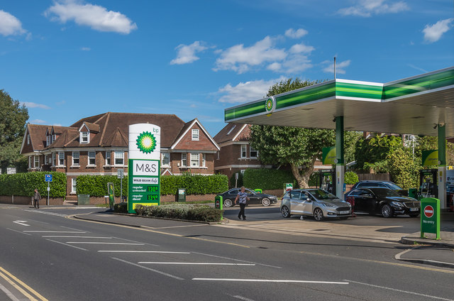
Image: © Ian Capper Taken: 5 Sep 2019
BP Petrol Station on Kingston Road, by its junction with Park Rise. This junction was originally the site of a pond, Bradmere Pond, which was filled in in 1906. Old maps show the centre of the pond to have been at this junction, with Kingston Road (in the foreground) a relatively narrow track, and it seems that its removal was needed to allow the road to be widened. Originally only the top end of Park Rise was developed, and this site was initially undeveloped. A building is shown on the 1939 1:2,500 map, with later editions marking it (with enlargement) as a garage. Hill Rise Court, in the left background, was a 2002 subsequent redevelopment of the corner site.
Images are licensed for reuse under creativecommons.org/licenses/by-sa/2.0
Image Location
Latitude
51.298266
Longitude
-0.330613