The Near Boot, Whiteclosegate
Introduction
The photograph on this page of The Near Boot, Whiteclosegate by Roger Templeman as part of the Geograph project.
The Geograph project started in 2005 with the aim of publishing, organising and preserving representative images for every square kilometre of Great Britain, Ireland and the Isle of Man.

There are currently over 7.5m images from over 14,400 individuals and you can help contribute to the project by visiting https://www.geograph.org.uk
The Near Boot, Whiteclosegate
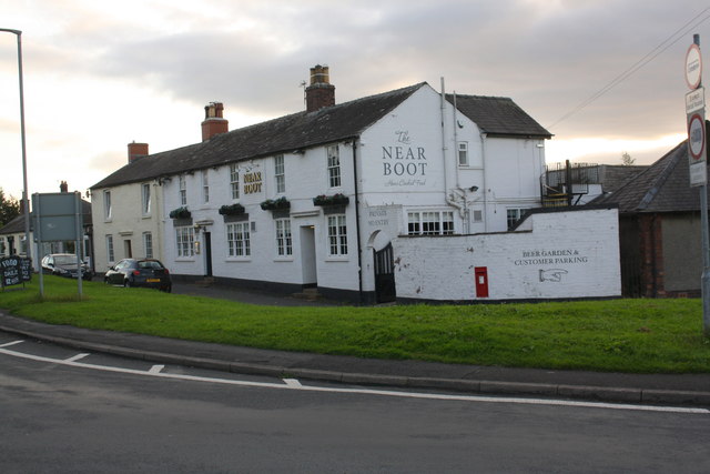
Image: © Roger Templeman Taken: 16 Sep 2019
18th century Coaching Inn whose unusual name derives from the near-side boot when riding out of Carlisle. The Ordnance Survey cut a benchmark Image in January 1844 (1GL Survey) levelled at 98.166 feet above Liverpool Datum on a door jamb half way along the road face of the inn. A more recent mark Image was levelled at 30.02m above Newlyn Datum in 1972 at the NE end of the road face, by the black downpipe
Images are licensed for reuse under creativecommons.org/licenses/by-sa/2.0
Image Location
Latitude
54.913223
Longitude
-2.919363