Beyond the beans ? Haseley
Introduction
The photograph on this page of Beyond the beans ? Haseley by Robin Stott as part of the Geograph project.
The Geograph project started in 2005 with the aim of publishing, organising and preserving representative images for every square kilometre of Great Britain, Ireland and the Isle of Man.

There are currently over 7.5m images from over 14,400 individuals and you can help contribute to the project by visiting https://www.geograph.org.uk
Beyond the beans ? Haseley
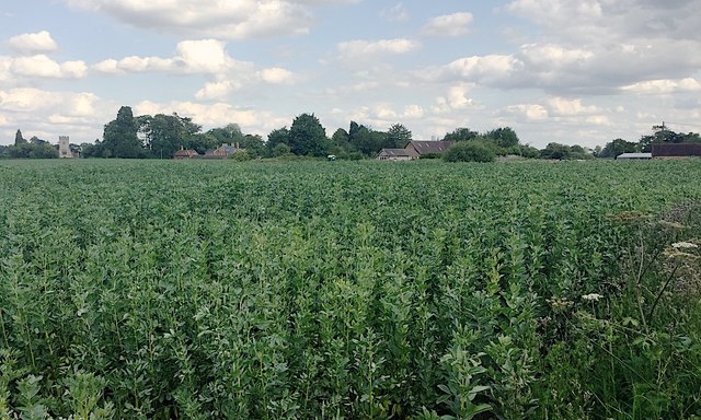
Image: © Robin Stott Taken: 7 Jul 2019
The view is from the Birmingham Road A4177. Haseley is a scatter of buildings, typical of Arden. From left to right: the Church of St Mary the Virgin, the parish church, then Haseley Coach House B&B and Haseley House; they are on Firs Lane. On the right edge of the photo is the single-storey back of The Falcon pub on the Birmingham Road; to its left is a sizeable cottage to the rear of the pub.
Images are licensed for reuse under creativecommons.org/licenses/by-sa/2.0
Image Location
Latitude
52.309722
Longitude
-1.662748