Duloe stone circle, B3254, Duloe
Introduction
The photograph on this page of Duloe stone circle, B3254, Duloe by Jo and Steve Turner as part of the Geograph project.
The Geograph project started in 2005 with the aim of publishing, organising and preserving representative images for every square kilometre of Great Britain, Ireland and the Isle of Man.

There are currently over 7.5m images from over 14,400 individuals and you can help contribute to the project by visiting https://www.geograph.org.uk
Duloe stone circle, B3254, Duloe
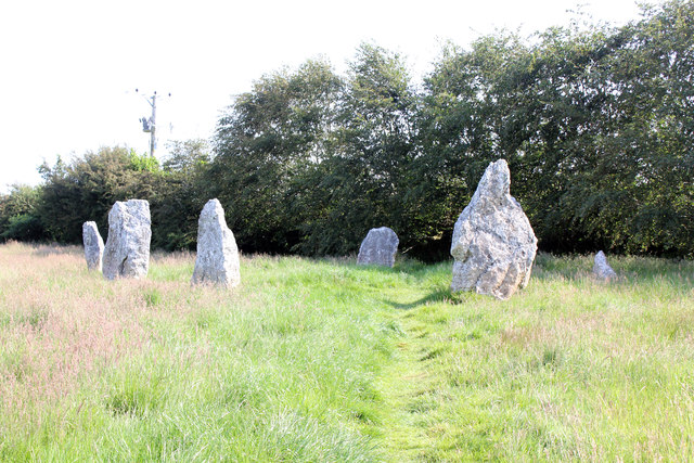
Image: © Jo and Steve Turner Taken: 27 Jun 2019
Scheduled Monument. The circle was originally bisected by a hedge which was removed in 1858 and in 1863 three stones were re-erected and a Bronze Age ribbon-handled urn, containing cremated human bones, was found at the base of the NNE stone during a vain attempt to raise the broken stone. There is some discrepancy over accounts of this discovery - whether the urn was found beneath the fallen stone or recovered from the hedge that bisected the site. WC Borlase inferred from the discovery that there may have been a raised mound or stony cairn within the circle and it does seem reasonable to interpret the monument as the impressive kerb or peristalith of an imposing Bronze Age burial monument. The stones do roughly align to the points of the compass suggesting a possible ceremonial observance of astronomical events. Later smaller stones have been added although it is unclear when these date to.
Images are licensed for reuse under creativecommons.org/licenses/by-sa/2.0
Image Location
Latitude
50.398037
Longitude
-4.48364