
A970, Welcome to Brae
Introduction
The photograph on this page of A970, Welcome to Brae by David Dixon as part of the Geograph project.
The Geograph project started in 2005 with the aim of publishing, organising and preserving representative images for every square kilometre of Great Britain, Ireland and the Isle of Man.

There are currently over 7.5m images from over 14,400 individuals and you can help contribute to the project by visiting https://www.geograph.org.uk
A970, Welcome to Brae
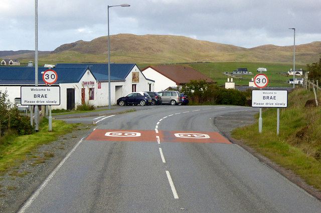
Image: © David Dixon Taken: 21 Sep 2018
The A970 which connects Lerwick to Northmavine forms the main street of Brae, a village located at the northern end of Busta Voe, on the narrow isthmus that joins Northmavine to the rest of the island of Mainland. Historically, Brae was a small fishing village but in the 1970s it grew rapidly, largely due to the construction of the nearby Sullom Voe Oil Terminal, merging with the nearby village of Northbrae. Brae's police and fire stations, schools, and NHS clinic service much of the northern part of the Mainland.
Images are licensed for reuse under creativecommons.org/licenses/by-sa/2.0
Image Location

Latitude
60.38749
Longitude
-1.347854