Disused railway line, King's Weston Lane, Avonmouth
Introduction
The photograph on this page of Disused railway line, King's Weston Lane, Avonmouth by Brian Robert Marshall as part of the Geograph project.
The Geograph project started in 2005 with the aim of publishing, organising and preserving representative images for every square kilometre of Great Britain, Ireland and the Isle of Man.

There are currently over 7.5m images from over 14,400 individuals and you can help contribute to the project by visiting https://www.geograph.org.uk
Disused railway line, King's Weston Lane, Avonmouth
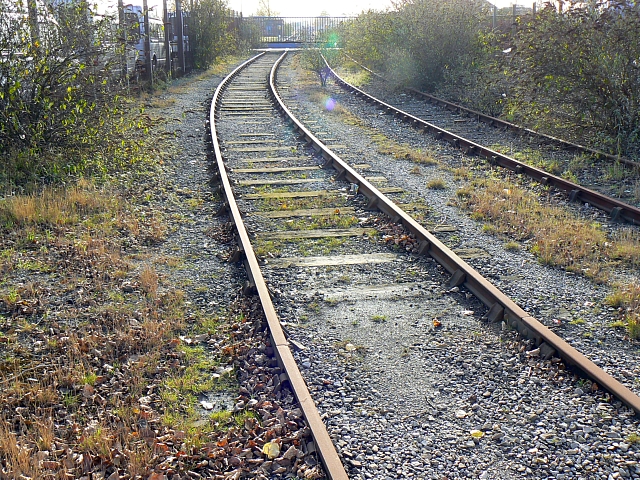
Image: © Brian Robert Marshall Taken: 25 Nov 2007
Still in situ but no longer used, the line used to serve the chemical complex that takes up most of the square. The main company here, Rhodia, is to cease production here in 2008 ending a production history that began in 1917. More here in this rather outdated pdf http://www.rhodia.co.uk/media/cws/rhodia_in_the_country/global_locations/uk/docs/plant_data_sheet/en/Avonmouth_v1_m56577569830657403.pdf and the death warrant http://www.rhodia.co.uk/cws/news_detail.jsp?CONTENT%3C%3Ecnt_id=10134198673430770&FOLDER%3C%3Efolder_id=9852723696667367&bmUID=1196030536783
Images are licensed for reuse under creativecommons.org/licenses/by-sa/2.0
Image Location
Latitude
51.514538
Longitude
-2.692247