Old Wayside Cross at Stoning Cross, Hatherleigh
Introduction
The photograph on this page of Old Wayside Cross at Stoning Cross, Hatherleigh by Alan Rosevear as part of the Geograph project.
The Geograph project started in 2005 with the aim of publishing, organising and preserving representative images for every square kilometre of Great Britain, Ireland and the Isle of Man.

There are currently over 7.5m images from over 14,400 individuals and you can help contribute to the project by visiting https://www.geograph.org.uk
Old Wayside Cross at Stoning Cross, Hatherleigh
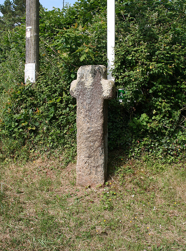
Image: © Alan Rosevear Taken: 19 Jun 2010
Hatherleigh Park Cross (Stoning), old head, shaft and base, by the UC road, in parish of Hatherleigh (West Devon District), Stoning Cross, East end of Park Road at junction with Victoria Road, on a bank below the signpost and telegraph pole. Grade II listed. List Entry Number: 1165724 https://historicengland.org.uk/listing/the-list/list-entry/1165724 Scheduled Monument. List Entry Number: 1013715 https://historicengland.org.uk/listing/the-list/list-entry/1013715 Surveyed Milestone Society National ID: DVWD_HAT02
Images are licensed for reuse under creativecommons.org/licenses/by-sa/2.0
Image Location
Latitude
50.82164
Longitude
-4.063955