Old Direction Sign - Signpost by the B3092, White Post
Introduction
The photograph on this page of Old Direction Sign - Signpost by the B3092, White Post by Milestone Society as part of the Geograph project.
The Geograph project started in 2005 with the aim of publishing, organising and preserving representative images for every square kilometre of Great Britain, Ireland and the Isle of Man.

There are currently over 7.5m images from over 14,400 individuals and you can help contribute to the project by visiting https://www.geograph.org.uk
Old Direction Sign - Signpost by the B3092, White Post
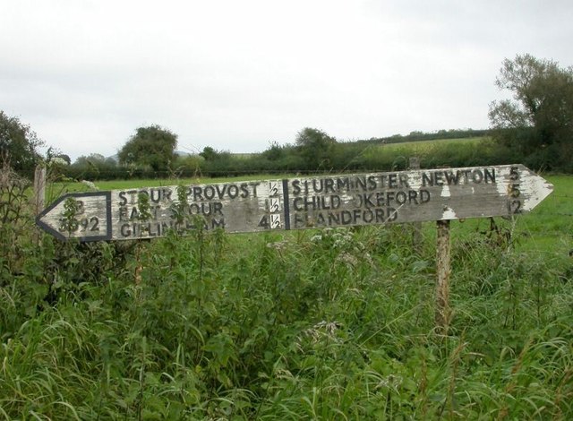
Image: © Milestone Society Taken: Unknown
Annulus finial - 3 arms; Dorset annulus without NGR by the B3092, in parish of Stour Provost (North Dorset District), White Post, T-junction with UC road to Fifehead Magdalen, on verge, East side of road. Surveyed Milestone Society National ID: DO_ST7920
Images are licensed for reuse under creativecommons.org/licenses/by-sa/2.0
Image Location


Leaflet Map data © OpenStreetMap
Latitude
50.98438
Longitude
-2.293844