Old Milestone by the A494, north of Llanelidan
Introduction
The photograph on this page of Old Milestone by the A494, north of Llanelidan by Milestone Society as part of the Geograph project.
The Geograph project started in 2005 with the aim of publishing, organising and preserving representative images for every square kilometre of Great Britain, Ireland and the Isle of Man.

There are currently over 7.5m images from over 14,400 individuals and you can help contribute to the project by visiting https://www.geograph.org.uk
Old Milestone by the A494, north of Llanelidan
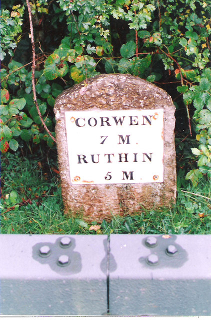
Image: © Milestone Society Taken: Unknown
Corwen Plate (replica plate) by the A494, in parish of Llanelidan (Denbighshire District), North of Hendre Isaf, Southwest of Nantclwyd Hall. Behind the South end of the Armco barrier, South side of road. Inscription reads:- CORWEN 7 M RUTHIN 5 M Grade II listed by Cadw. Reference Number: 25002 https://cadwpublic-api.azurewebsites.net/reports/listedbuilding/FullReport?lang=&id=25002 Surveyed Milestone Society National ID: DEN_CNRU07
Images are licensed for reuse under creativecommons.org/licenses/by-sa/2.0
Image Location


Leaflet Map data © OpenStreetMap
Latitude
53.052486
Longitude
-3.335406