Old Milestone by the A5, Cerrigydrudion
Introduction
The photograph on this page of Old Milestone by the A5, Cerrigydrudion by Milestone Society as part of the Geograph project.
The Geograph project started in 2005 with the aim of publishing, organising and preserving representative images for every square kilometre of Great Britain, Ireland and the Isle of Man.

There are currently over 7.5m images from over 14,400 individuals and you can help contribute to the project by visiting https://www.geograph.org.uk
Old Milestone by the A5, Cerrigydrudion
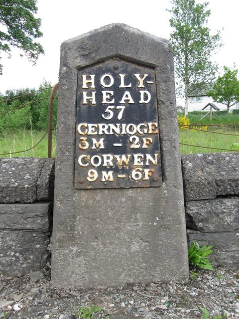
Image: © Milestone Society Taken: Unknown
Telford Plate by the A5, in parish of Cerrigydrudion (Conwy County Borough District), in Cerrigydrudion, opposite Saracen's Head PH. Plate 'Lost' after 2016. Inscription reads:- HOLY- HEAD 57 CERNIOGE 3M - 2F CORWEN 9M - 6F Grade II listed by Cadw. Reference Number: 19340 https://cadwpublic-api.azurewebsites.net/reports/listedbuilding/FullReport?lang=&id=19340 Surveyed Milestone Society National ID: DEN_HH57
Images are licensed for reuse under creativecommons.org/licenses/by-sa/2.0
Image Location
Latitude
53.023629
Longitude
-3.562635