Pont Begard - foot and bicycle bridge over the Elwy, St Asaph
Introduction
The photograph on this page of Pont Begard - foot and bicycle bridge over the Elwy, St Asaph by Eirian Evans as part of the Geograph project.
The Geograph project started in 2005 with the aim of publishing, organising and preserving representative images for every square kilometre of Great Britain, Ireland and the Isle of Man.

There are currently over 7.5m images from over 14,400 individuals and you can help contribute to the project by visiting https://www.geograph.org.uk
Pont Begard - foot and bicycle bridge over the Elwy, St Asaph
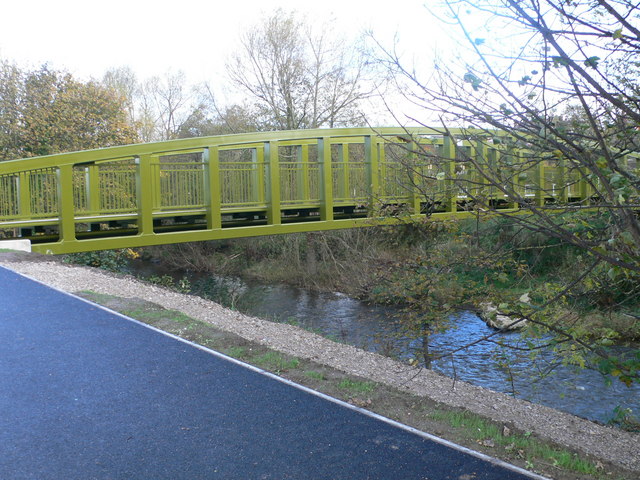
Image: © Eirian Evans Taken: 9 Nov 2007
The bridge, named Pont Begard after St. Asaph's twin town, is designed to connect east and west St. Asaph. It's certainly built to last which is wise given that, in the recent past, floodwaters have risen as high as the bicycle path that is shown on the photo. It's strong enough and wide enough to take a vehicle in an emergency.
Images are licensed for reuse under creativecommons.org/licenses/by-sa/2.0
Image Location
Latitude
53.25778
Longitude
-3.449519