Old Milestone by the A3090, Ranvilles Farm, Romsey Extra parish
Introduction
The photograph on this page of Old Milestone by the A3090, Ranvilles Farm, Romsey Extra parish by K Lawrence as part of the Geograph project.
The Geograph project started in 2005 with the aim of publishing, organising and preserving representative images for every square kilometre of Great Britain, Ireland and the Isle of Man.

There are currently over 7.5m images from over 14,400 individuals and you can help contribute to the project by visiting https://www.geograph.org.uk
Old Milestone by the A3090, Ranvilles Farm, Romsey Extra parish
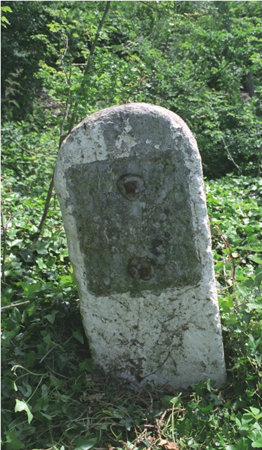
Image: © K Lawrence Taken: 26 May 2003
Stone post (plate lost) by the A3090, in parish of ROMSEY EXTRA (TEST VALLEY District), Ranvilles Farm; 50m South of farm entrance, on grass verge, on East side of road. Romsey rectangle stone, erected by the Romsey & Ringwood turnpike trust in the 19th century. Inscription once read:- (Romsey 2) (Ringwood 16) Grade II listed. List Entry Number: 1093652 https://historicengland.org.uk/listing/the-list/list-entry/1093652 Milestone Society National ID: HA_RORI02.
Images are licensed for reuse under creativecommons.org/licenses/by-sa/2.0
Image Location
Latitude
50.967616
Longitude
-1.522381