Old Direction Sign - Signpost by Trethurgy, Treverbyn parish
Introduction
The photograph on this page of Old Direction Sign - Signpost by Trethurgy, Treverbyn parish by Milestone Society as part of the Geograph project.
The Geograph project started in 2005 with the aim of publishing, organising and preserving representative images for every square kilometre of Great Britain, Ireland and the Isle of Man.

There are currently over 7.5m images from over 14,400 individuals and you can help contribute to the project by visiting https://www.geograph.org.uk
Old Direction Sign - Signpost by Trethurgy, Treverbyn parish
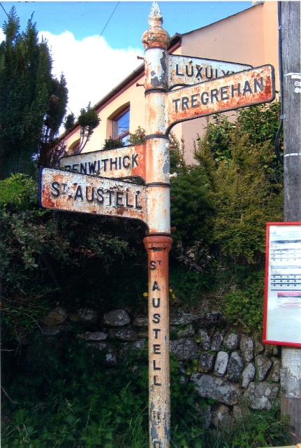
Image: © Milestone Society Taken: Unknown
Pyramid finial - 4 arms; St Austell RDC by the UC road, in parish of Treverbyn (Restormel District), North end of Trethurgy village, on verge by bus stop. Cornwall & Scilly HER. HER Number: MCO56827 https://www.heritagegateway.org.uk/Gateway/Results_Single.aspx?uid=MCO56827&resourceID=1020 Surveyed Milestone Society National ID: CW_SX0355B
Images are licensed for reuse under creativecommons.org/licenses/by-sa/2.0
Image Location


Leaflet Map data © OpenStreetMap
Latitude
50.367351
Longitude
-4.760924