Old Milestone by Ermine Street, Brockworth parish
Introduction
The photograph on this page of Old Milestone by Ermine Street, Brockworth parish by M Faherty as part of the Geograph project.
The Geograph project started in 2005 with the aim of publishing, organising and preserving representative images for every square kilometre of Great Britain, Ireland and the Isle of Man.

There are currently over 7.5m images from over 14,400 individuals and you can help contribute to the project by visiting https://www.geograph.org.uk
Old Milestone by Ermine Street, Brockworth parish
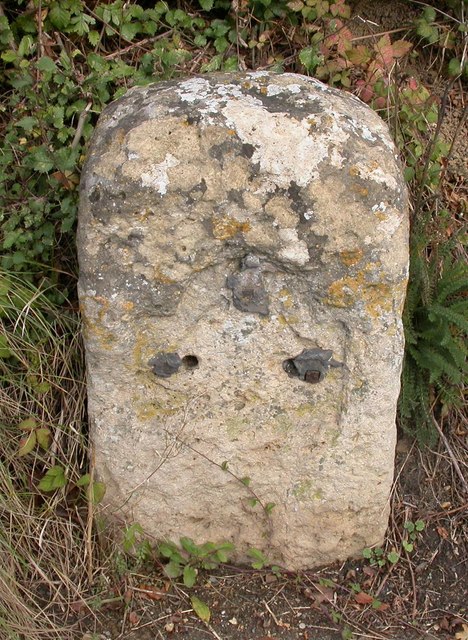
Image: © M Faherty Taken: 16 Oct 2009
Stone post (plate lost) by the UC road (Ermin Way), in parish of BROCKWORTH (TEWKESBURY District), Ermin Street; 70m East of junction with Vicarage Lane in front No.89, on the verge, on North side of road. Northgate plate, erected by the Northgate turnpike trust in the 18th century. Inscription once read:- (Gloucester) (4) Gloucestershire County Council HER. HER: 35155 https://www.heritagegateway.org.uk/Gateway/Results_Single.aspx?uid=35155&resourceID=108 Milestone Society National ID: GL_GLBL04.
Images are licensed for reuse under creativecommons.org/licenses/by-sa/2.0
Image Location
Latitude
51.845445
Longitude
-2.157889