Old Guide Stone by Aish Cross, South Brent Parish
Introduction
The photograph on this page of Old Guide Stone by Aish Cross, South Brent Parish by Alan Rosevear as part of the Geograph project.
The Geograph project started in 2005 with the aim of publishing, organising and preserving representative images for every square kilometre of Great Britain, Ireland and the Isle of Man.

There are currently over 7.5m images from over 14,400 individuals and you can help contribute to the project by visiting https://www.geograph.org.uk
Old Guide Stone by Aish Cross, South Brent Parish
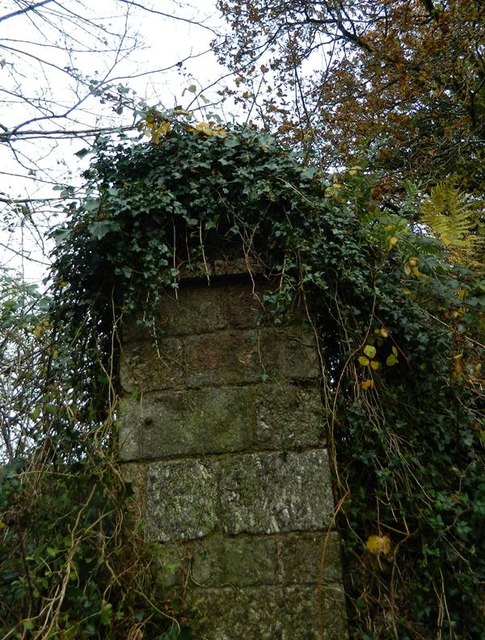
Image: © Alan Rosevear Taken: 17 Nov 2012
Stone pillar by the UC road, in parish of South Brent (South Hams District), Aish Cross, corner of Aish Lane, 400m West of Old Brent Mill Bridge on old road to Wrangaton, on grass verge; one of two pillars - the old gateway to Summerswood estate, now overgrown. See also: DV_XSBR02B Image and https://www.flickr.com/photos/tollhouses/8193545342/in/datetaken/ for both pillars together. Both pillars have inscriptions, see:- Devon & Dartmoor HER. HER Number: MDV71595 https://historicengland.org.uk/listing/the-list/map-search?clearresults=True/#?search=ST69118552 Surveyed Milestone Society National ID: DV_XSBR02A
Images are licensed for reuse under creativecommons.org/licenses/by-sa/2.0
Image Location
Latitude
50.420795
Longitude
-3.840123