Old Milestone by the B4058 in the parish of Rangeworthy
Introduction
The photograph on this page of Old Milestone by the B4058 in the parish of Rangeworthy by R Shackell as part of the Geograph project.
The Geograph project started in 2005 with the aim of publishing, organising and preserving representative images for every square kilometre of Great Britain, Ireland and the Isle of Man.

There are currently over 7.5m images from over 14,400 individuals and you can help contribute to the project by visiting https://www.geograph.org.uk
Old Milestone by the B4058 in the parish of Rangeworthy
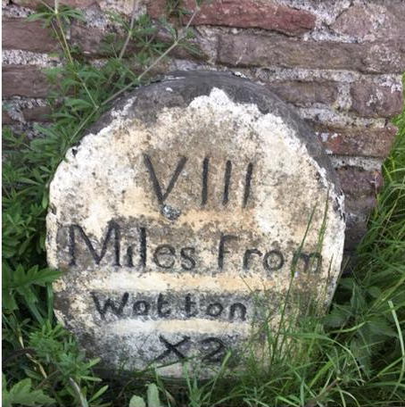
Image: © R Shackell Taken: 14 Mar 2015
Carved stone post by the B4058, in parish of Rangeworthy (South Gloucestershire District), Wotton Road, 30m East of Laurel House, Northeast corner of garden wall. Wotton stone, erected by the Wotton under Edge (Division) turnpike trust in the 19th century. Inscription reads:- VIII Miles from Wotton X2 Bristol Grade II listed. List Entry Number: 1116022 https://historicengland.org.uk/listing/the-list/list-entry/1116022 Milestone Society National ID: GL_WERY08.
Images are licensed for reuse under creativecommons.org/licenses/by-sa/2.0
Image Location
Latitude
51.567736
Longitude
-2.446918