Old Boundary Marker by the A4, London Road East, Swainswick parish
Introduction
The photograph on this page of Old Boundary Marker by the A4, London Road East, Swainswick parish by Milestone Society as part of the Geograph project.
The Geograph project started in 2005 with the aim of publishing, organising and preserving representative images for every square kilometre of Great Britain, Ireland and the Isle of Man.

There are currently over 7.5m images from over 14,400 individuals and you can help contribute to the project by visiting https://www.geograph.org.uk
Old Boundary Marker by the A4, London Road East, Swainswick parish
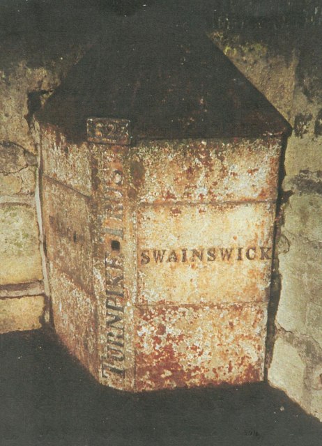
Image: © Milestone Society Taken: Unknown
Parish Boundary Marker - Turnpike by the A4, in parish of Swainswick (Bath And North East Somerset District), London Road East; near junction with Old Gloucester Road, on pavement attached to wall behind, and set into bridge parapet over Lam Beck, North side of road. Inscription reads:- : WALCOT : : 1827 / TURNPIKE TRUST : : SWAINSWICK : Grade II listed. List Entry Number: 1394831 https://historicengland.org.uk/listing/the-list/list-entry/1394831 Surveyed Milestone Society National ID: SO_BACH01pb
Images are licensed for reuse under creativecommons.org/licenses/by-sa/2.0
Image Location
Latitude
51.396469
Longitude
-2.341555