Old Milepost by the former A66, Brougham parish
Introduction
The photograph on this page of Old Milepost by the former A66, Brougham parish by CF Smith as part of the Geograph project.
The Geograph project started in 2005 with the aim of publishing, organising and preserving representative images for every square kilometre of Great Britain, Ireland and the Isle of Man.

There are currently over 7.5m images from over 14,400 individuals and you can help contribute to the project by visiting https://www.geograph.org.uk
Old Milepost by the former A66, Brougham parish
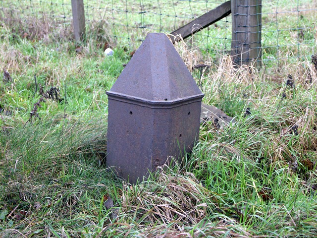
Image: © CF Smith Taken: 13 Dec 2005
Metal post with lost metal plates by the UC road (was A66), in parish of BROUGHAM (EDEN District), near Winderwath Farm, on grass verge, on West side of road. Appleby plate, erected by the Brough & Eamont Bridge turnpike trust in the 19th century. Probably originally located at GR: Image on the modern A66 by Swine Gill Plantation, North side of road. Inscription once read:- : (APPLEBY / 9 / MILES) : : (PENRITH / 4 / MILES) : Milestone Society National ID: WE_PRAP05.
Images are licensed for reuse under creativecommons.org/licenses/by-sa/2.0
Image Location
Latitude
54.651335
Longitude
-2.633613