Old Milestone by the A281, Horsham Road, Shalford Parish
Introduction
The photograph on this page of Old Milestone by the A281, Horsham Road, Shalford Parish by L Joseph & H&KC as part of the Geograph project.
The Geograph project started in 2005 with the aim of publishing, organising and preserving representative images for every square kilometre of Great Britain, Ireland and the Isle of Man.

There are currently over 7.5m images from over 14,400 individuals and you can help contribute to the project by visiting https://www.geograph.org.uk
Old Milestone by the A281, Horsham Road, Shalford Parish
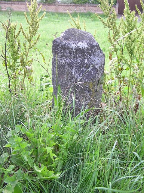
Image: © L Joseph & H&KC Taken: 13 Sep 2005
Carved stone post by the A281, in parish of SHALFORD (GUILDFORD District), Horsham Road, opposite Stonebridge Wharf, in grass, by bus shelter, on East side of road. Horsham Facet, erected by the Horsham & Guildford (Alfold) turnpike trust in the 19th century. Inscription reads:- : HORSHAM / 18 MILES : : BRIGHTON / 40 : : (GUILDFORD / 2) : Milestone Society National ID: SY_BRGF40.
Images are licensed for reuse under creativecommons.org/licenses/by-sa/2.0
Image Location
Latitude
51.209301
Longitude
-0.569579