Old Boundary Marker by the A2, Blackheath Hill SE10
Introduction
The photograph on this page of Old Boundary Marker by the A2, Blackheath Hill SE10 by Milestone Society as part of the Geograph project.
The Geograph project started in 2005 with the aim of publishing, organising and preserving representative images for every square kilometre of Great Britain, Ireland and the Isle of Man.

There are currently over 7.5m images from over 14,400 individuals and you can help contribute to the project by visiting https://www.geograph.org.uk
Old Boundary Marker by the A2, Blackheath Hill SE10
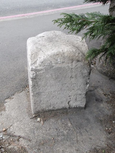
Image: © Milestone Society Taken: Unknown
Municipal Boundary Marker by the A2, in parish of Greenwich (Greenwich District), Blackheath Hill SE10, North West corner of Point Hill, next to Cypress trees. Inscription taken from Historic England reads:- : (illegible) yards from this point is the boundary of the Borough of Greenwich : Grade II listed. List Entry Number: 1079051 https://historicengland.org.uk/listing/the-list/list-entry/1079051 Surveyed Milestone Society National ID: KE_GREHB01pb.
Images are licensed for reuse under creativecommons.org/licenses/by-sa/2.0
Image Location
Latitude
51.472835
Longitude
-0.008487